ArcGIS Field Maps
Designing accuracy-focused workflows for survey-grade data collection
Project Overview
ArcGIS Field Maps evolved from a simple data capture tool into a comprehensive solution for survey-grade accuracy in mobile environments. The challenge was making advanced geodesy workflows accessible to field workers without deep GIS expertise.
My Role
Lead UX Designer
Timeline
18 months
Team
PM, Engineers, Geodesy Experts
Platform
iOS, Android
The Challenge
ArcGIS Field Maps started as a way for crews to capture and edit GIS data in the field. Over time, the demands grew: utilities, natural resource agencies, and survey teams needed survey-grade accuracy in a mobile app.
Configuring external GNSS receivers, applying grid transformations, and supporting real-time corrections like RTK introduced complexity far beyond the typical "blue dot on a map."
The challenge: make these advanced geodesy workflows usable by anyone in the field, without requiring deep GIS knowledge.
My Role
I led design for GNSS receiver setup, grid transformations, and local RTK UX. I also worked closely with the team on core collection workflows: point capture, line creation, offset streaming, and averaging.
My focus was on simplifying complex configuration tasks into guided, mobile-friendly flows while ensuring accuracy-critical details were not lost.
Process
Research and Validation
Partnered with product managers and geodesy experts to understand the requirements for high-accuracy workflows.
Reviewed how competitors and dedicated survey devices handled these features.
Interviewed field users to understand pain points around configuring external receivers and applying transformations.
Interaction Design
Created UX flows for connecting GNSS receivers and exposing their status.
Designed a structured way for users to apply grid transformations and manage RTK corrections without being overwhelmed.
Prototyped offset, streaming, and averaging workflows to balance flexibility with simplicity.
Collaboration and Iteration
Worked closely with engineers to align on what was technically feasible in the mobile environment.
Iterated on early flows after feedback from field testers who worked under real-world conditions (low connectivity, time pressure).
The Solution
Receiver Config
Receiver Configuration
A clear, step-by-step setup for external GNSS receivers, showing accuracy status, battery, and connection health.
Grid & RTK
Grid Transformations and RTK
A simplified UX for applying local grid transformations and connecting to RTK networks. Users could set these once and trust Field Maps to keep corrections active.
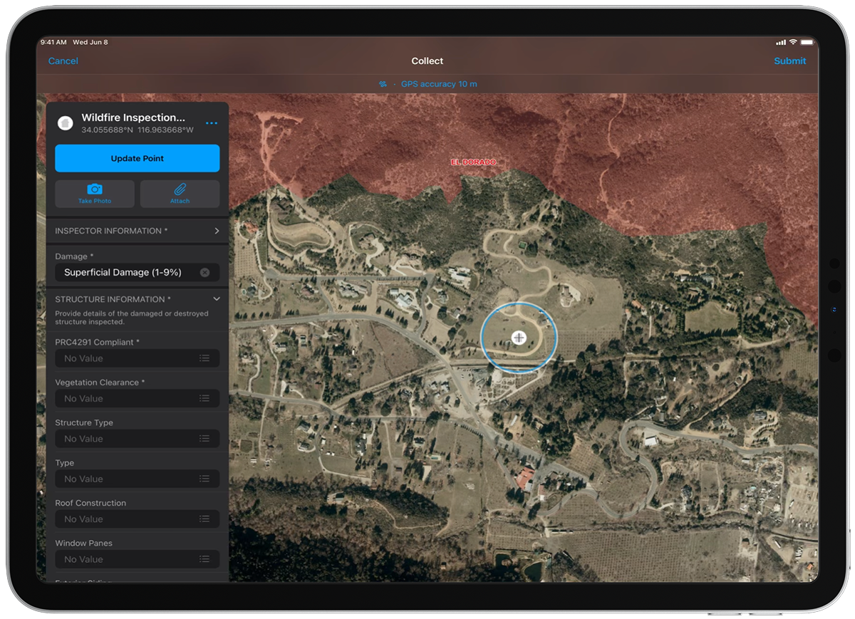
Collection
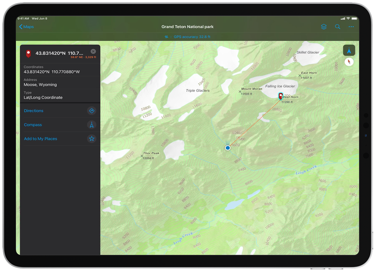
Point and Line Collection
Improved workflows for capturing single points, streaming positions for lines, and using offsets. Averaging multiple fixes gave users confidence in accuracy without slowing them down.
The Impact
Expanded Use Cases
Field Maps became viable not only for basic data capture but for survey-grade workflows, reducing the need for dedicated hardware.
Industry Adoption
Utilities, transportation, and natural resource agencies could standardize on a single app across crews.
Confidence in Accuracy
By simplifying the complexity of geodesy, we helped ensure that data collected in the field aligned with enterprise GIS standards.